Spatial Data Processing with
PostgreSQL & PostGIS
Işıl Demir
VisioThink Inc.
May 2012
What is spatial data?
Geospatial Data is information with geographic attributes, describing features and boundaries on Earth, usually stored as coordinates and topology.
Nowadays, any data can be geospatial, thanks to Facebook, Twitter, Foursqaure, Google Places etc.
What is a geospatial database?
Well where else would we store all this spatial data?
A spatial database is a database that is optimized to store and query data that is related to objects in space, including points, lines and polygons.
- Spatial Measurements
- Spatial Functions
- Spatial Predicates
- Constructor Functions
- Observer Functions
What does spatial data look like?

PostGIS spatially enables the PostgreSQL server
Why spatial databases?
- Maps are cool
- They are even cooler when used for data visualization purposes
Population distribution across departments in France
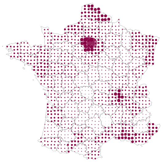
http://kartograph.org
6Crime data for some US cities
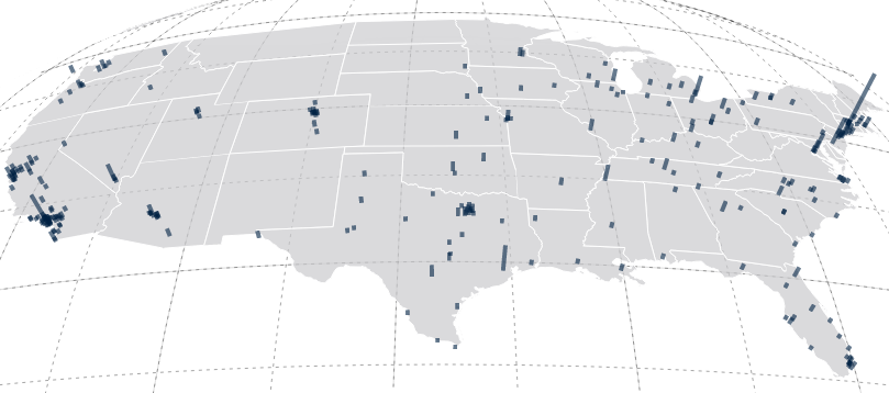
http://kartograph.org
7Unemployment rates in Spain
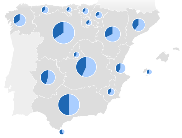
http://kartograph.org
8Why spatial databases?
- Location Intelligence
- The capacity to organize and understand complex phenomena through the use of geographic relationships by combining geographic- and location-related data with other business data
- Finance
- Healthcare
- Media: Target Market
Why PostgreSQL & PostGIS?
- Free, Open source
- Big, live community
- Seamless integration with PHP, MapServer, OpenLayers
- PostGIS follows the Simple Features for SQL specification from the Open Geospatial Consortium (OGC)
- Handles big data, no problem
Loading spatial data
- OpenStreetMap - Daily updates, big shape files
- shp2pgsql
- CSV
Talking GIS: Projections, spatial references
Once you install PostGIS, you will have two very important tables:
- geometry_columns
- spatial_ref_sys
spatial_ref_sys
This tables lists over 3000 known spatial reference systems and details needed to transform/reproject between them
| srid | spatial reference string |
|---|---|
| 4326 | GEOGCS["WGS 84", DATUM["WGS_1984", SPHEROID["WGS 84", 6378137, 298.257223563, AUTHORITY["EPSG","7030"]], TOWGS84[0,0,0,0,0,0,0], AUTHORITY["EPSG","6326"]], PRIMEM["Greenwich",0,AUTHORITY["EPSG","8901"]], UNIT["degree",0.01745329251994328, AUTHORITY["EPSG","9122"]], AUTHORITY["EPSG","4326"]] |
- The spatial reference system you use to project your geographic data is very important!
- Every spatial measurement and function depends on it!
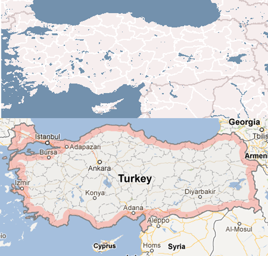
Turkey with UTM Zone 35N and WGS84 projections
spatial_ref_sys
// WGS84 (World Geodetic System; standard in cartography, navigation)
SELECT * FROM public.spatial_ref_sys WHERE auth_srid = 4326;
// UTM35N (Transverse Mercator projection for Turkey)
SELECT * FROM public.spatial_ref_sys WHERE auth_srid = 32635;
| srid | spatial reference string |
|---|---|
| 4326 | GEOGCS["WGS 84", DATUM["WGS_1984", SPHEROID["WGS 84", 6378137, 298.257223563, AUTHORITY["EPSG","7030"]], TOWGS84[0,0,0,0,0,0,0], AUTHORITY["EPSG","6326"]], PRIMEM["Greenwich",0,AUTHORITY["EPSG","8901"]], UNIT["degree",0.01745329251994328, AUTHORITY["EPSG","9122"]], AUTHORITY["EPSG","4326"]] |
| 32635 | "PROJCS["WGS 84 / UTM zone 35N", GEOGCS["WGS 84", DATUM["WGS_1984",SPHEROID["WGS 84", 6378137, 298.257223563, AUTHORITY["EPSG","7030"]], TOWGS84[0,0,0,0,0,0,0], AUTHORITY["EPSG","6326"]], PRIMEM["Greenwich",0,AUTHORITY["EPSG","8901"]], UNIT["degree",0.01745329251994328, AUTHORITY["EPSG","9122"]], AUTHORITY["EPSG","4326"]], PROJECTION["Transverse_Mercator"], PARAMETER["latitude_of_origin",0], PARAMETER["central_meridian",27], PARAMETER["scale_factor",0.9996], PARAMETER["false_easting",500000], PARAMETER["false_northing",0], UNIT["metre",1,AUTHORITY["EPSG","9001"]], AUTHORITY["EPSG","32635"]]" |
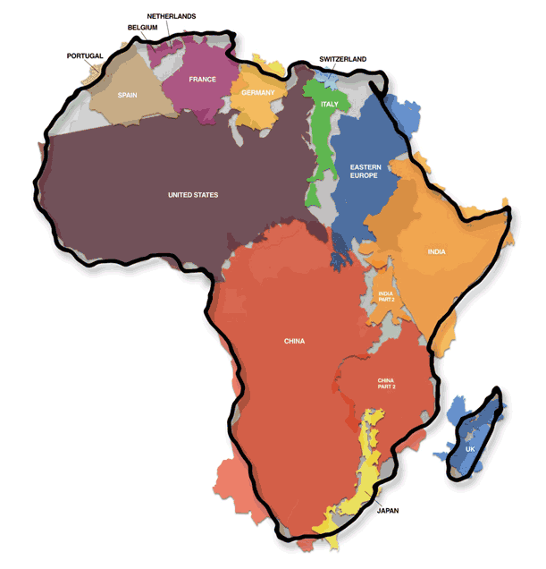
Transverse Mercator Projection of the World
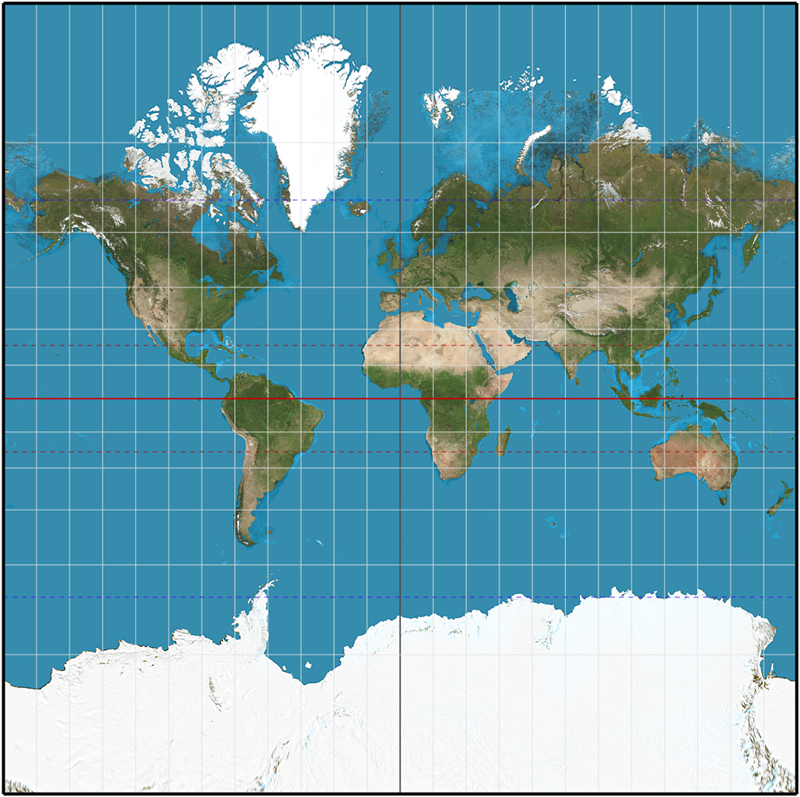
The true size of Africa
The coolness of PostGIS?
You can project one coordinate to another spatial reference by using ST_Transform.
More on that later.
Simple spatial queries
Create a point
SELECT st_geomfromtext('POINT(29.009399 41.043045)', 4326);
| st_geomfromtext (geometry) |
|---|
| 0101000020E6100000779D0DF967023D40CFA0A17F82854440 |
Same point, different projection
SELECT st_astext(
 st_transform(st_geomfromtext('POINT(29.009399 41.043045)', 4326), 32635));
| st_astext (text) |
|---|
| POINT(668888.377502433 4545480.51687201) |
Some spatial functions
- st_within
- st_buffer
- st_distance
- st_union
- st_intersect
- st_centroid
http://postgis.refractions.net/docs/reference.html
ST_Distance: Why projections are important
Let's calculate the distance between Istanbul and Ankara
SELECT st_distance(
  st_geomfromtext('POINT(28.983307 41.017211)', 4326),
  st_geomfromtext('POINT(32.852554 39.930274)', 4326));
| st_distance (double precision) |
|---|
| 4.01901783884794 |
SELECT st_distance_sphere(
  st_geomfromtext('POINT(28.983307 41.017211)', 4326),
  st_geomfromtext('POINT(32.852554 39.930274)', 4326));
| st_distance_sphere (double precision) |
|---|
| 348848.891192477 ~ 350 km |
ST_Distance: Why projections are important
Let's calculate the distance between Istanbul and Ankara
SELECT st_distance(
 st_transform(st_geomfromtext('POINT(28.983307 41.017211)', 4326), 32635),
 st_transform(st_geomfromtext('POINT(32.852554 39.930274)', 4326), 32635));
| st_distance (double precision) |
|---|
| 349949.722459394 |
But we know for sure the distance is actually 453km!
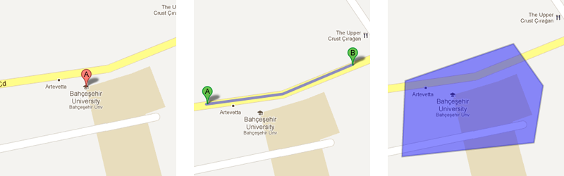
- pgRouting project: extends the PostGIS/PostgreSQL geospatial database to provide geospatial routing functionality
Online maps
Now that we can store and query spatial objects, how do we display the results on a map?
- OpenStreetMap: The data provider
- MapServer: Map tile renderer
- OpenLayers: Stitch it together with some magical JavaScript
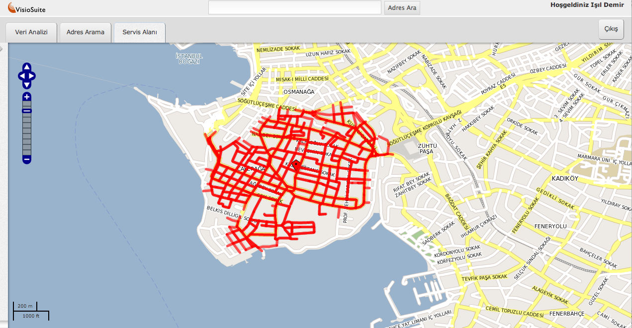
In a nutshell; use PostgreSQL+PostGIS to store the geographic data provided by OpenStreetMap, build your own map using MapServer and display it with OpenLayers
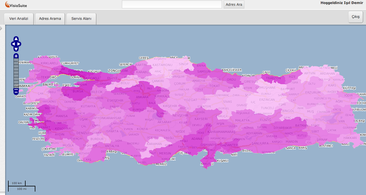
VisioSuite: Population density per city
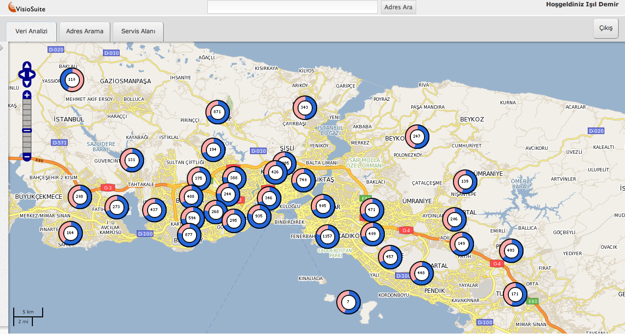
VisioSuite: Education and healthcare centers
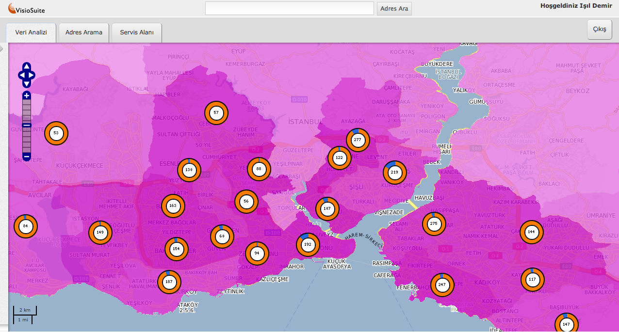
VisioSuite: Education level for each district and education centers
VisioSuite: Routing